Introduction
Hello! My name is Tamara and I am a senior Computer Science Major at Earlham College and this is my capstone project. I am interested in applying machine learning and other computational techniques for better understanding of social issues. Here is the abstract of my capstone project proposal.
Abstract
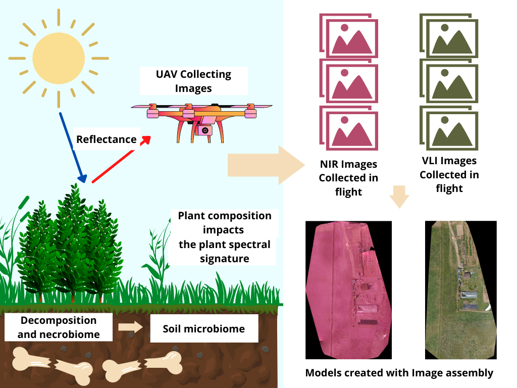
Unmanned Aerial Vehicles (UAV) have in recent years opened new doors in image analysis and remote sensing. Data collected through these devices in combination with available satellite imagery has a notable potential in improving remote sensing strategies and the quality of input data and thus the accuracy of its results. This computational technique can be applied to solve a wide range of societal issues. The aim of this study is to examine the role of this approach of remote sensing and image processing in detection of clandestine graves. Furthermore, the study compares the use of near infrared (NIR) and visual light images (VLI) taken by drones to detect hidden graves. It is aiming to compare how accurately the graves can be detected post-image processing using the same edge detection technique. The primary motivation is to help future researchers more easily decide which data collection technique they should use in their research.
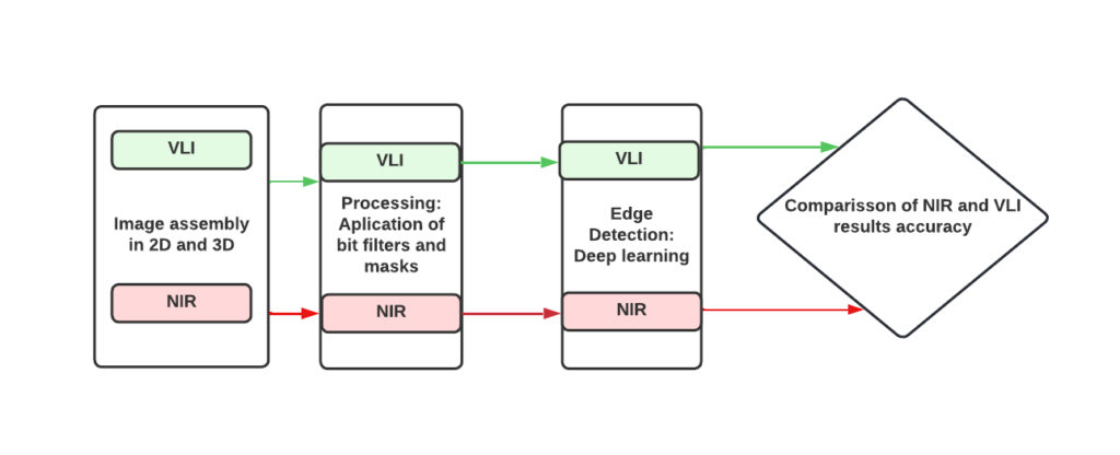
Software Architecture Diagram