Geospatial Data Analytics for Policy Impact Assessment: Amazon Deforestation in Colombia
This capstone project examines deforestation in the Colombian Amazon through the lens of both environmental data and public policy, with a particular focus on the impacts of Colombia’s 2016 Peace Agreement. Using satellite imagery and computational analysis, the project examines how post-conflict dynamics, land-use changes, and governance structures impact forest loss in one of the world’s most biodiverse regions.
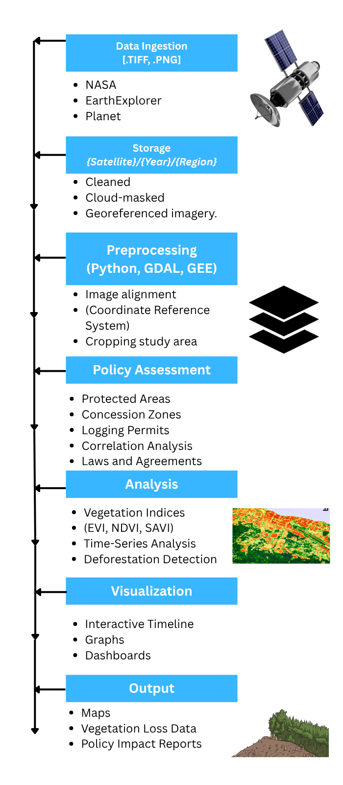
The project integrates multiple remote-sensing data sources, including Landsat-derived land cover maps from NASA EarthData, modeled deforestation scenarios extending to 2050, and independent forest-loss data from Global Forest Watch. I designed a reproducible geospatial pipeline using Python, QGIS, and raster analysis techniques to process GeoTIFF imagery, perform pixel-level land-cover classification, and convert satellite data into quantitative measures of forest loss and recovery. Custom scripts automate pixel counting, batch processing, visualization, and video generation, demonstrating how computer science methods can scale environmental monitoring across large spatial and temporal datasets.
Beyond technical analysis, this work situates deforestation trends within Colombia’s socio-political context, comparing observed forest loss before and after the Peace Agreement and evaluating how policy-driven governance scenarios differ from business-as-usual projections. The results show that while deforestation continues under all scenarios, governance and conservation policies are associated with slower forest loss compared to no-intervention models.
Data Architecture Diagram
Poster
Paper
GitHub Repository
https://github.com/marchmich/Capstone