Abstract
With the increase in the number of forest fires worldwide, especially in the West of the United States, there is an urgent need to develop a reliable fire propagation model to aid fire fighting as well as save lives and resources. Wildfire spread simulation is used to predict possible fire behavior, which is essential in assisting fire management and training purposes. This paper proposed an agent-based model that simulates wildfire using a cellular automata approach. The proposed model incorporated a machine learning technique to automatically calculate the igniting probability without the need to manually adjust the input data for a specific location.
Software architecture diagram
The program includes three large components: the input service, the simulation model, and the output service.
The input service processes users inputs. The input includes diffusion coefficient, ambient temperature, ignition temperature, burn temperature, matrix size, and a wood density data set. All of the inputs can be set to default values if users choose not to provide data. The wood density data set can also be auto-generated if a real-world data set is not provided.
The simulation model is the most important component of the program. This part consists of two main parts, fire temperature simulation service and the wood density simulation service. As the names suggest, the fire temperature simulation service is responsible for processing how fire temperature changes throughout the simulation process. The wood density simulation service is in charge of processing the changes in wood density of the locations described in the input when fire passes through.
The final component, the output service, creates a graph at each time step, and puts together the graphs into a gif file. By using the gif file, users can visualize how fire spreads given the initial inputs.
Design Overview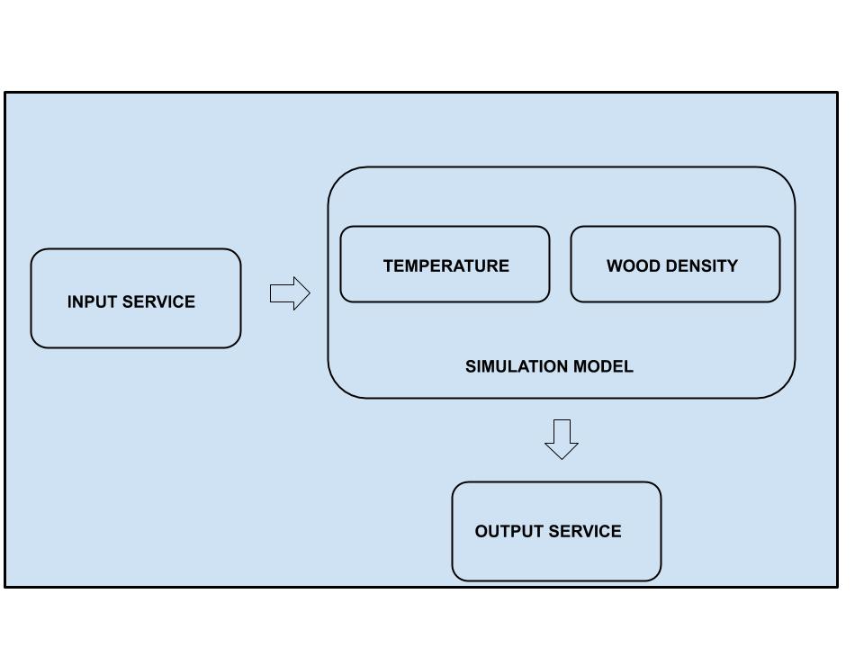
Simulation Model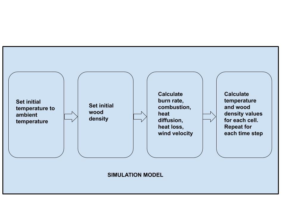
Link to the final version of the paper
https://drive.google.com/file/d/1d4UQhkRWoYSxDWYb5SY-lca6QLaZFJMZ/view?usp=sharing